Posts tagged 2022
Synthetic Infrastructure (SyNF) Solutions to Improve the Sustainability of Energy Infrastructure Systems

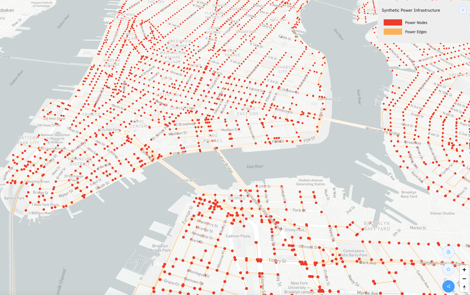
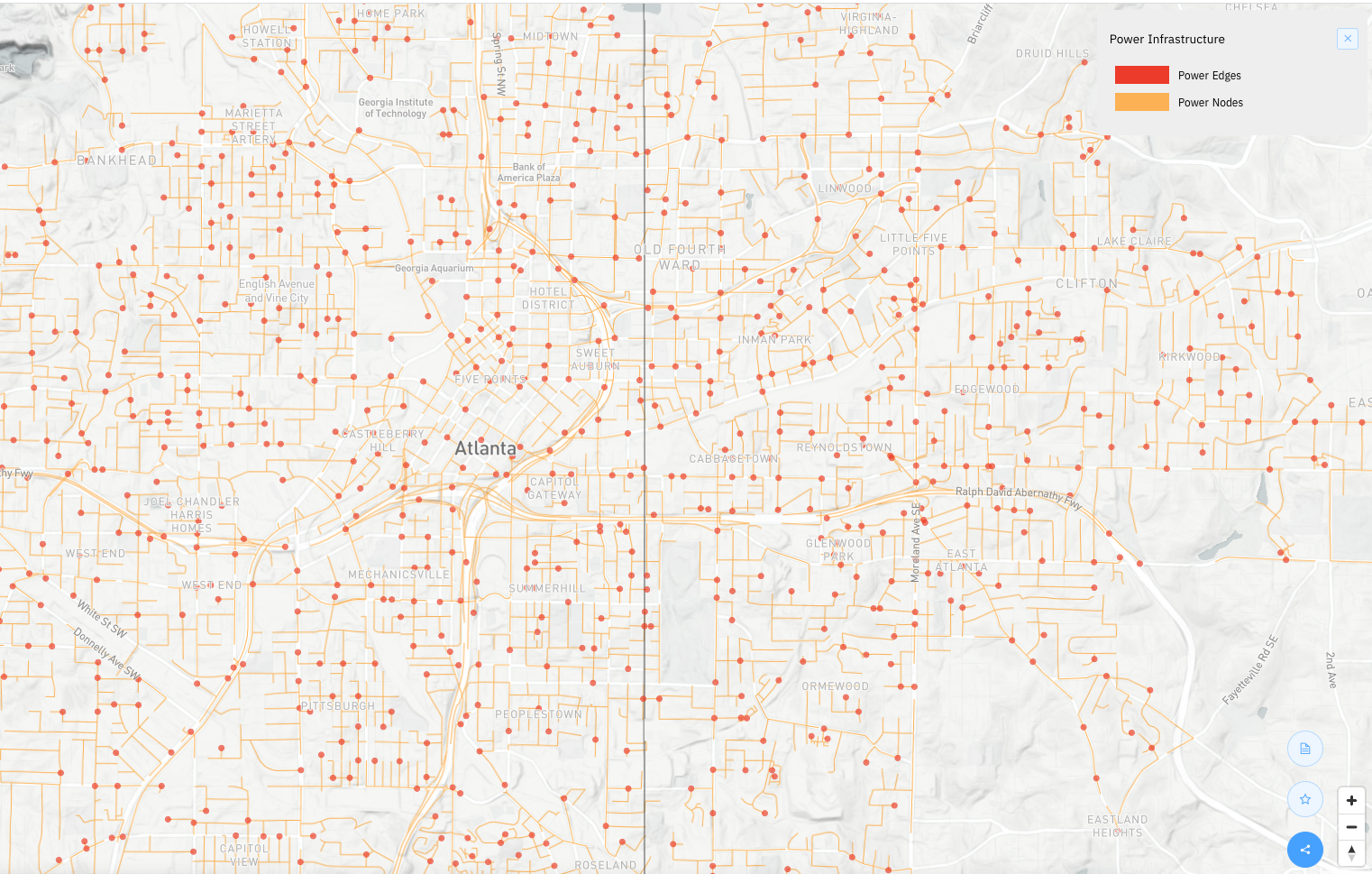
This initiative brings together researchers at the Urban Systems Lab, Arizona State University (ASU) and Georgia State University (GSU) to co-develop synthetic infrastructure models for Phoenix, New York City and Atlanta that will simulate critical failure in energy distribution systems and potential cascading impacts on other power, water, and transportation infrastructure during extreme events to optimize solutions, and improve reliability and robustness. The custom coded synthetic infrastructure modeling environment (SyNF model) links multiple data sources to ultimately generate new synthetic energy network data that attempts to mimic real-world energy networks and therefore not only fills energy network data gaps, but provides the novel ability to examine failure scenarios and their cascading impacts to other energy dependent infrastructure networks.

The effort will seek to answer the following research questions:

  • How can new and emerging data and modeling approaches, such as synthetic infrastructure modeling, be used to diagnose energy system vulnerabilities, reveal potential for cascading failure that impacts energy and connected power, water, and transportation infrastructure?

  • Additionally, how vulnerable are critical energy infrastructure components from internal or external disruptions such as extreme weather and climate? How can these new modeling approaches generate new knowledge to drive development of more adaptive urban energy infrastructure design?

Support provided by the Sloan Foundation.

Milwaukee Flood Health Vulnerability Assessment

The Milwaukee Flood and Health Vulnerability Assessment (FHVA) is a collaborative effort between Groundwork Milwaukee and The New School’s Urban Systems Lab to develop an assessment tool which identifies communities across Milwaukee where exposure to urban flooding and pre-existing health, housing and socioeconomic conditions intersect and create disproportionate vulnerabilities to the impacts caused by extreme flooding. The aim of the project is to provide critical information on both flood exposure and social vulnerability to support community-based advocacy and future planning to mitigate potential flood and health risks. 

Link to Storymap

Link to Report (PDF)

Milwaukee Flood and Health Vulnerability Assessment Storymap

Climate Ready Uptown Plan

The Climate Ready Uptown Plan (CRUP) is a guide and map to help Northern Manhattan community members understand their individual risk to climate related disasters – specifically extreme heat, coastal and inland flooding – and provides pertinent information to help prepare themselves and their families. Designed by WE ACT for Environmental Justice in partnership with East Harlem COAD, Harlem Emergency Network and Urban Systems Lab, the Plan is tailored to residents of Northern Manhattan to better understand their flood risk. From the onset, CRUP was designed with community at the forefront. WE ACT’s Climate Justice Working Group helped with the initial planning, research and layout of the tool, and scenario planning meetings as well as focus groups with Northern Manhattan residents helped WE ACT refine the messaging and language included in the plan to make it as effective and relatable as possible.

DOWNLOAD MAP

Town+Gown: Climate Vulnerability, Impact, and Adaptation Analysis (VIA)

The Town+Gown: Climate Vulnerability, Impact, and Adaptation Analysis (VIA) project is co-led by Professors Joel Towers and Dr. Timon McPhearson at The New School to carry out a $2.5M study on future climate change and its potential impacts to inform decision-making by the City of New York and assessment reports by the NYC Panel on Climate Change and the Mayor’s Office of Climate and Environmental Justice (MOCEJ).

The team includes scientists from nine academic institutions (The New School, Columbia University, Cornell University, City University of New York, Drexel University, Lamont Doherty Earth Observatory, Sarah Lawrence College, Science and Resilience Institute at Jamaica Bay, and Stevens Institute of Technology), four governmental institutions and nonprofit organizations (Natural Resources Defense Council, Population Council, NASA/GISS, and USDA Forest Service) and from the private sector (Arcadis). Together, this team will work collaboratively to develop a comprehensive analysis of future potential climate conditions and associated socio-economic impacts in New York City. Specifically, the team will:

  • Develop climate projections for the NYC region, including high resolution heat risk and exposure projections, storm surge risk analysis, and coastal flood mapping,

  • Characterize current and future extreme heavy rainfall in New York City,

  • Conduct a systematic assessment of health-related economic costs from climate-sensitive events in New York City, and

  • Create a Coastal Flooding Vulnerability Index for New York City

Press Release